
TL;DR
- Calgary’s four quadrants are an addressing system, not neighbourhoods. The City draws them along Centre Street, the Bow River and Memorial Drive.
- Always keep the quadrant on an address. The same street name can exist in two quadrants on opposite sides of downtown.
- CREB reports prices by eight districts, not four quadrants, so match your price research to its district map.
- Pick a commute first (CTrain line, Deerfoot, Stoney Trail), then a quadrant, then two or three communities to visit.
- In October 2026, CREB said detached prices were rising in the City Centre and West districts and falling most in the North East.
If you’re moving to Calgary from another city, the first thing you’ll notice is that every address ends in NW, NE, SW or SE. People here describe where they live by quadrant, and listings, schools and commutes all get sorted that way. This guide explains what the quadrants actually tell you, what they don’t, and a simple way to narrow a whole city down to a short list of communities before you fly in to see homes.
What Calgary’s quadrants are (and aren’t)
The quadrants are lines on a map. The City of Calgary describes them as dividing the city along an east–west and north–south axis “for administrative purposes based on Centre St., the Bow River and Memorial Drive” (City of Calgary quadrant boundaries). Every street address carries one of the four quadrant qualifiers (City of Calgary addressing).
Three things catch newcomers out:
- The quadrant is part of the address. 17 Avenue SW and 17 Avenue SE are both real, busy streets, on different sides of downtown. Leave the quadrant off a search, a delivery or a viewing booking and you may end up in the wrong place.
- Most of the downtown core is SW. An SW address can be a downtown condo tower or a new house at the city’s edge.
- A quadrant is huge. Each one runs from inner-city streets built before the war out to communities still under construction. “We want the NW” is a starting point, not an answer.
Quadrants vs. CREB districts: use the right map for prices
The Calgary Real Estate Board (CREB) doesn’t report prices by quadrant. It splits the city into eight districts: City Centre, North, North East, East, South, South East, West and North West (CREB community map). The districts don’t line up neatly with the quadrants, so a community’s address quadrant and its CREB district can sound different. When you compare prices, look the community up on CREB’s map first.
For a sense of the current market, CREB’s October 2026 release put the citywide unadjusted benchmark prices at:
- Detached: $735,100
- Semi-detached: $685,200
- Row: $407,500
- Apartment condominium: $288,800
CREB also said the City Centre and West districts were still reporting detached price gains over 2025, while detached prices in the North East district had declined by more than six per cent. Apartments and row homes had more supply and leaned toward buyers, while detached and semi-detached markets were relatively balanced (CREB, October 2026). Benchmarks describe a typical home, not any one listing, so treat them as a starting point.
Start with the commute, then choose the quadrant
Calgary is spread out, and the drive or train ride you’ll do every weekday matters more than the quadrant label. Before you look at a single listing, write down where you’ll work, where the kids will go to school and how you’d like to get there.
- CTrain Red Line: runs from Tuscany in the northwest, through downtown, to Somerset-Bridlewood in the south (Calgary Transit maps).
- CTrain Blue Line: runs from 69 Street in the west, through downtown, to Saddletowne in the northeast (Calgary Transit maps).
- Driving: Deerfoot Trail is the main north–south freeway east of downtown, and Stoney Trail rings much of the city. Living near one of them changes your commute far more than which side of Centre Street you’re on.
- Test it: on a visit, drive or ride your actual route at rush hour, both ways.
A quick field guide to the four quadrants
These are broad strokes. Every quadrant has older and newer areas, condos and houses, and a wide spread of prices.
Northwest (NW)
Home to the University of Calgary, Nose Hill Park and a long stretch of the Bow River valley. The Red Line’s northwest leg serves communities out to Tuscany. You’ll find established areas close to the university and newer communities toward the city’s northwest edge, closer to the highway west toward the mountains.
Northeast (NE)
The NE has the Calgary International Airport and the Blue Line’s northeast leg out to Saddletowne. It mixes inner-city communities near the Bow River with large newer suburbs further out. Given CREB’s October numbers above, buyers watching price trends may want to pay close attention to this district.
Southwest (SW)
The SW takes in most of downtown, the Elbow River, Glenmore Reservoir and Mount Royal University. The Blue Line’s west leg runs out to 69 Street. It ranges from inner-city streets with infills and older bungalows to newer hillside communities on the west side, which falls largely in CREB’s West district.
Southeast (SE)
The SE includes much of the city’s industrial land, the South Health Campus hospital and newer communities built around private resident lakes, such as Auburn Bay and Mahogany. Fish Creek Provincial Park runs along the south of the city, across both southern quadrants. Deerfoot Trail is the spine for many SE commutes.
Narrowing it down: a two-trip plan
- From home: pick one or two commute corridors and a property type (detached, semi, row or condo) that fits your budget, using the CREB benchmarks as a guide.
- Read the community profiles. The City publishes a profile for each community, based on the 2021 Census of Canada, with household and population details (City of Calgary community profiles).
- Check schools by address. Calgary’s public and Catholic boards each designate schools by home address. Use the CBE Find a School tool and the Calgary Catholic School Finder for any home you’re serious about. Don’t assume a school just because it’s close.
- First trip: spend a weekday and a weekend in your two or three shortlisted communities. Walk the streets, try the commute and visit a grocery store at 6 p.m.
- Second trip (or video tours): view specific homes, with the quadrant and community already settled.
Where a local agent helps
A good agent can save a relocating buyer weeks: they can do video viewings, tell you which blocks back onto a busy road, and explain why two similar-looking communities sell differently. If you’re searching for the best Calgary realtors to help with a move, ask how many relocation clients they’ve helped, which parts of the city they know best and how they handle viewings from a distance. Our list of the top real estate agents in Calgary is a place to start your shortlist, and our How We Rank page explains how it’s put together.
FAQ
Which Calgary quadrant is best for families?
There isn’t one. Every quadrant has family-friendly communities, so focus on the commute, the designated schools for the specific address, and parks you’ll actually use. Then compare two or three communities side by side.
Is the northeast cheaper than the rest of Calgary?
CREB reports districts, not quadrants. In its October 2026 release it said North East district detached prices had declined by more than six per cent, while the City Centre and West districts reported gains (CREB). Prices vary a lot by community and property type within any district.
How do I choose an agent if I don’t know the city yet?
Look for experience with relocation buyers and with the communities on your shortlist, and read their client reviews. Many people compare a few of the top Calgary realtors before choosing; our Top 5 list is one place to begin.
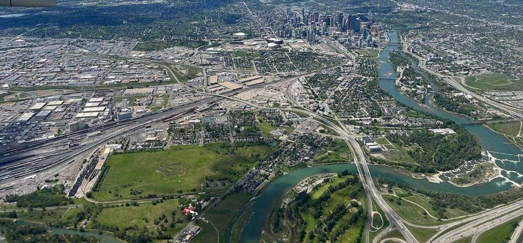
Header photo: “Calgary from the Air (2024)” by Michael Weinold, CC BY 4.0, via Wikimedia Commons (cropped and resized). This article is general information, not legal, tax or mortgage advice. Prices and transit routes change, so check the linked sources before you decide.


